Land forecasting brings multiple data sources into a single operational view. By combining weather, terrain, infrastructure, and environmental context, project teams gain a clearer basis for planning site activity and reducing uncertainty.
For field-intensive work, the value is not only in seeing tomorrow’s forecast but in understanding how conditions affect access, equipment deployment, and sequencing. A land forecast becomes a decision tool rather than a passive report.
At BW Geohydromatics, this template article demonstrates how a structured long-form page can present context, explain a workflow, and connect the story back to real services. The content is dummy content, but the page layout matches the Figma composition requested for implementation.
The same page template can support project updates, product explainers, and technical notes without needing a separate design for each category. That keeps the editorial system simple while preserving a consistent reading experience.
Below is a representative sample visual used as a placeholder inside this dummy article template.
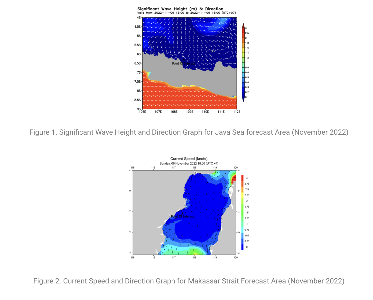
A sample report of the marine sea state prediction service can be seen here , and you can find more information about our other marine operation decision support system services here.
This route is intentionally backed by dummy content so the team can validate structure, spacing, and responsive behavior before wiring the page into a CMS or API.
